
Pastoralist Settlement Ecology in Kazakhstan
Modeling Pasture and mobility
Geographic Information Systems (GIS), remote sensing, and computer-assisted simulation, are key components in modeling pastoralist adapations in the past.
When attempting to document the mobility of herding societies across a given landscape, one must consider various factors that may have played a role in human experiences at different times and locales.
These factors range from ecological dynamics like seasonality, climate, and terrain, as well as social and political aspects of specific archaeological feature types. The spatial and temporal extents of ecological and social contexts themselves contribute to the pattern of land-use and landscape production, generated by mobile life-ways. Digital tools are incredibly powerful for simulating past conditions and enable the exploration and testing of various human strategies that would have been employed in the past. The aim of this project was to use digital approaches and analyses to model the economic and cultural landscapes of mobile pastoral societies of the Eastern Eurasian Steppes.
Our methods
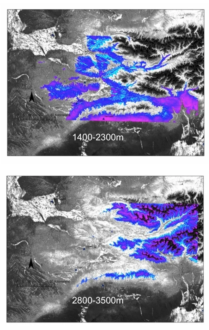
For pastoralists, perhaps the most important resource to their subsistence economy is green pasture. In the Dzhungar Mountains of eastern Kazakhstan, the size and productivity of pastures are directly correlated with seasonality and altitude. As a general rule, high altitude pastures (> 1400 m.a.s.l.) are more than three times as productive as pastures below 800 m a.s.l.
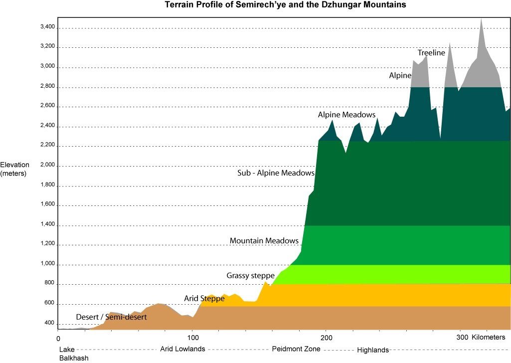
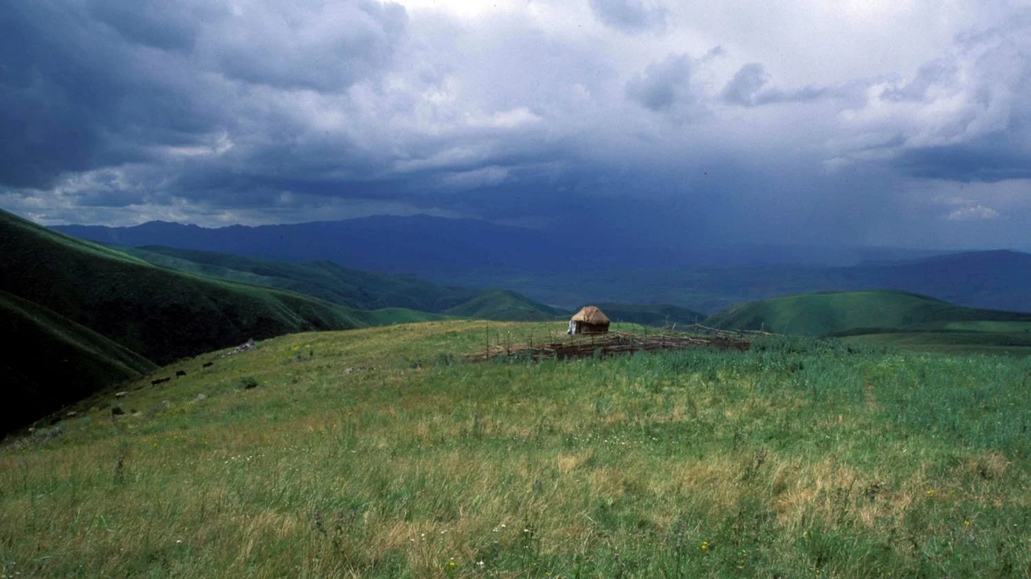
The environment of eastern Kazakhstan varies between sandy deserts, semi-arid grasslands, open steppe grasslands, and mountainous regions. The ecological variation between these gross zones is associated with extreme differences in precipitation, annual temperature change, soil quality, and elevation, all which affect the potential strategies for human occupation in each zone. In the Dzhungar region for example, the annual cycle of the continental climate traditionally played a considerable role in the patterns of movement of both animals and nomadic populations, especially in the mountain and desert regions where the difference between summer and winter pasture resources is pronounced.
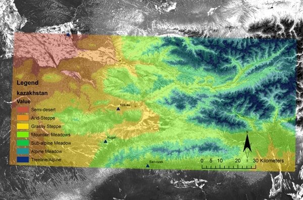
To accurately render the pasture resources in the Koksu Valley of Kazakhstan, an NDVI (Normalized Difference Vegetation Index) image was calculated in ERDAS Imagine using Landsat TM 7 base data. An NDVI image assigns values ranging from –1 to 1 to land-cover, according to the intensity of reflected chlorophyll in the vegetation (i.e. “greenness”). Using ArcGIS 8.2, the NDVI image was reclassified, assigning qualitatively ranked “productivity values” to vegetation indices greater than 0. Vegetation indices less than 0 represent poor vegetation coverage, i.e. areas of inadequate pasture potential. This revalued NDVI image was then resolved into four classes of grassland types according to known botanical composition of pastures at various altitude horizons. These include: 1) Alpine meadows; 2) Sub-alpine meadows; 3) Mountain steppes; and 4) semi-arid steppes. With a proposed map of the summer pasture resources we can then begin to model the potential movements of pastoral groups across the landscape.
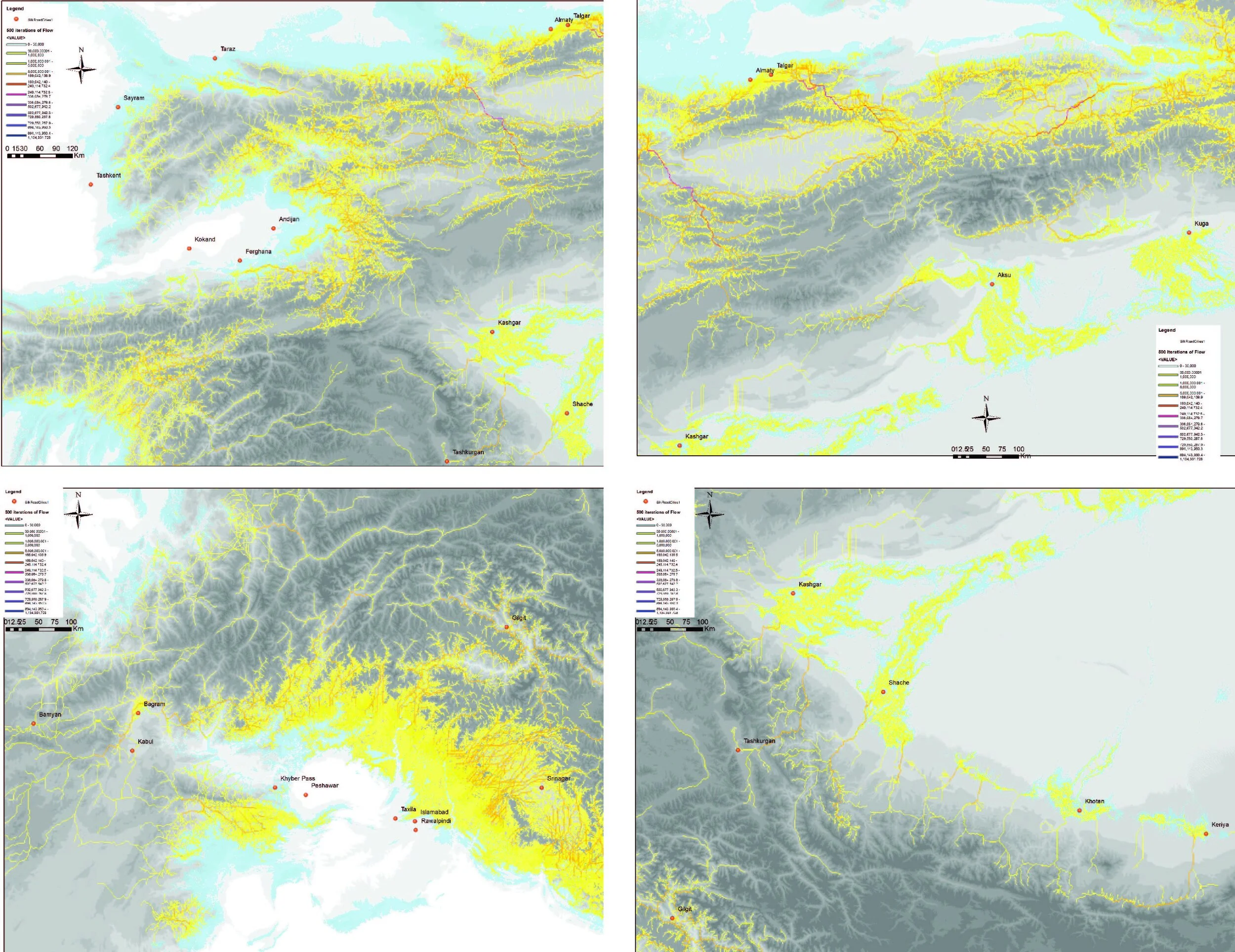
Mobility
This pathway map reflects the widest scale possibility for traveling across the landscape, provided good grass resources, and as pathways flow into one another (i.e. share a common track), the pathway is ranked as more likely (i.e. given a higher value).