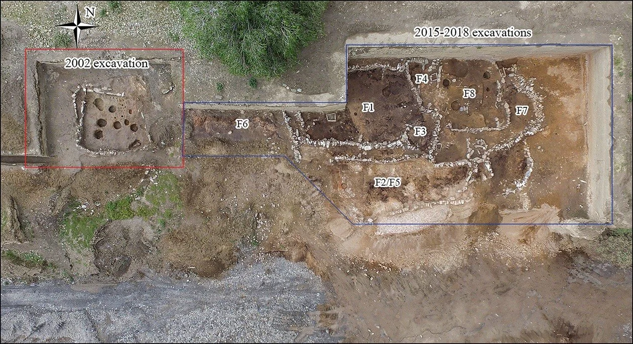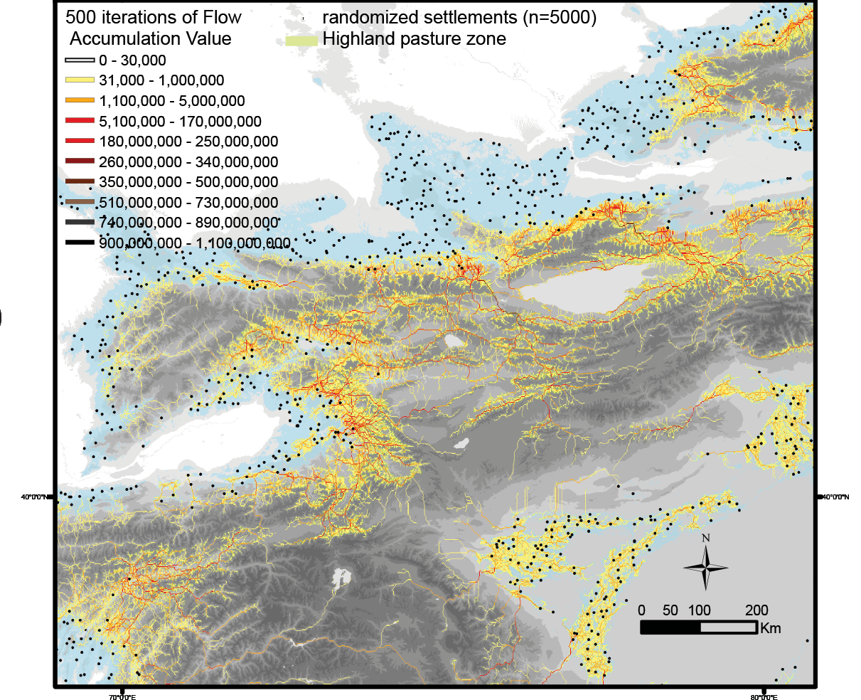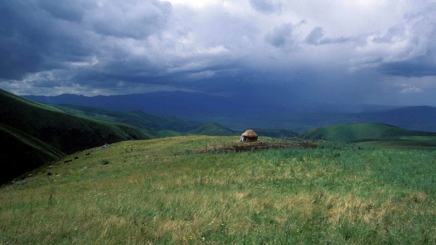
MODELING OUR FUTURE
GIS and Remote Sensing are the primary tools we employ at the SAIE lab to study the spatial and temporal intersection of human and environmental landscapes. Most of the analytical and material aspects of our research are tied together spatially and facilitate a holistic way of interpreting the complexity of cultural geography through time. The projects linked here focus directly on the spatial analytical methods we use to simulate and model various aspects of archaeological, climatic, ecological, and social phenomena from prehistory to the present day.
Featured