
Excavations at Dali, Kazakhstan
Archaeological excavations at the site complex of “Dali” – located in southeastern Kazakhstan – provide a rich picture of Bronze Age life spanning from the early third to late second millennia b.c. Nearly ten years of research at the site have produced an abundant assemblage of architectural remains, ritual and burial contexts, human and animal ancient DNA, as well as related economic, ceramic, and other forms of materiality. A systematic program of radiocarbon dating provides detailed chronological context for the numerous, stratigraphically documented phases of occupation, burial, and economy at the site. The settlement contexts at Dali provide some of the most varied and well-dated material assemblages known in the region and help illustrate how local pastoralist societies developed traditions of architecture, ceramic production, herd management, and ritual in the early Bronze Age, while innovating and incorporating novel craft techniques, economic strategies, burial styles, and settlement construction in the middle and late Bronze Age. Taken together, the archaeological data from Dali allow for a detailed reconstruction of the local practices and regional interactions that engaged agro-pastoralist communities within diverse, shared institutional domains across the Inner Asian Mountain Corridor – and beyond – over a span of more than 2000 years.
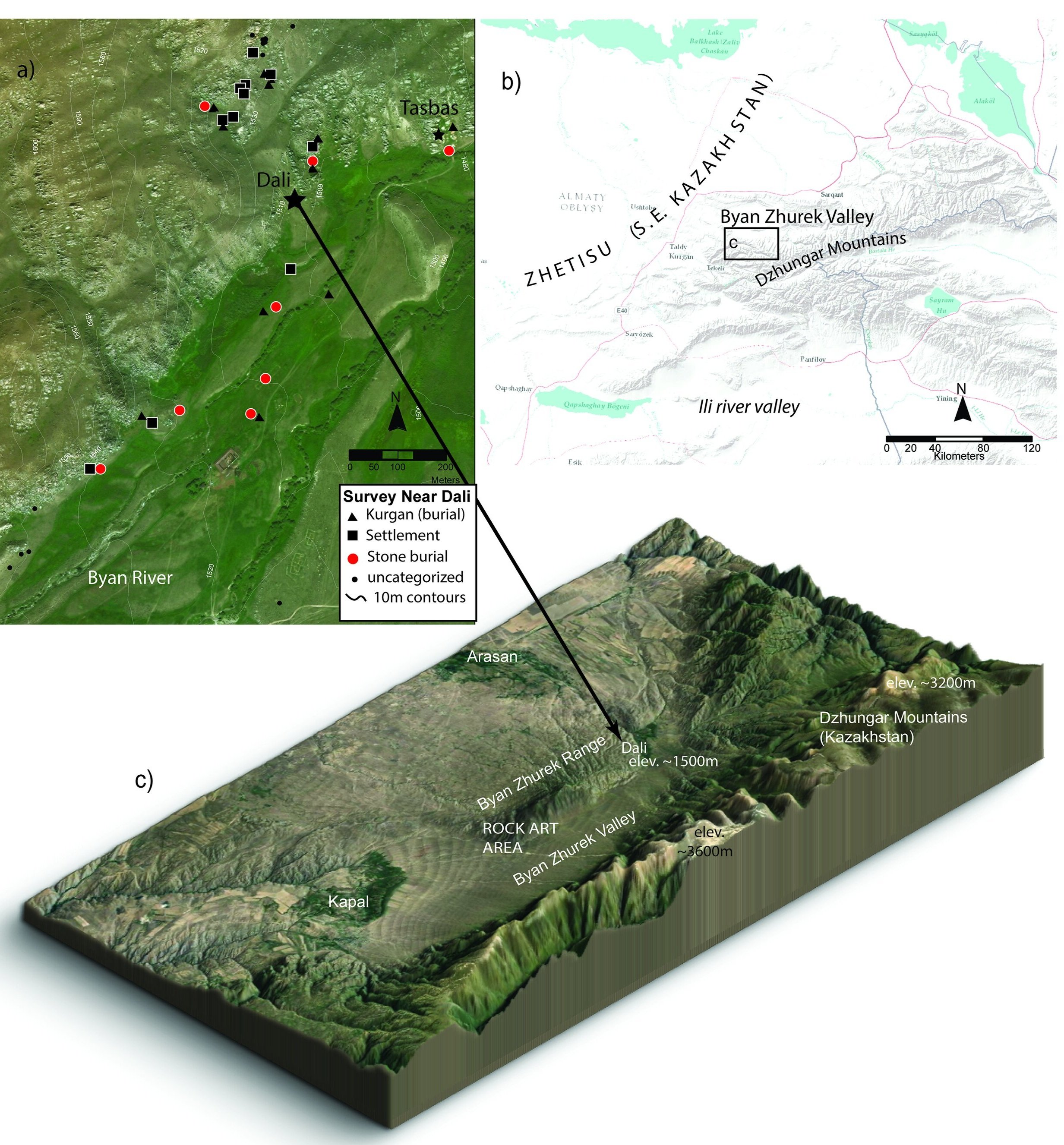
Sites located along the Inner Asian Mountain Corridor (Star > Dali)
Archaeological setting:
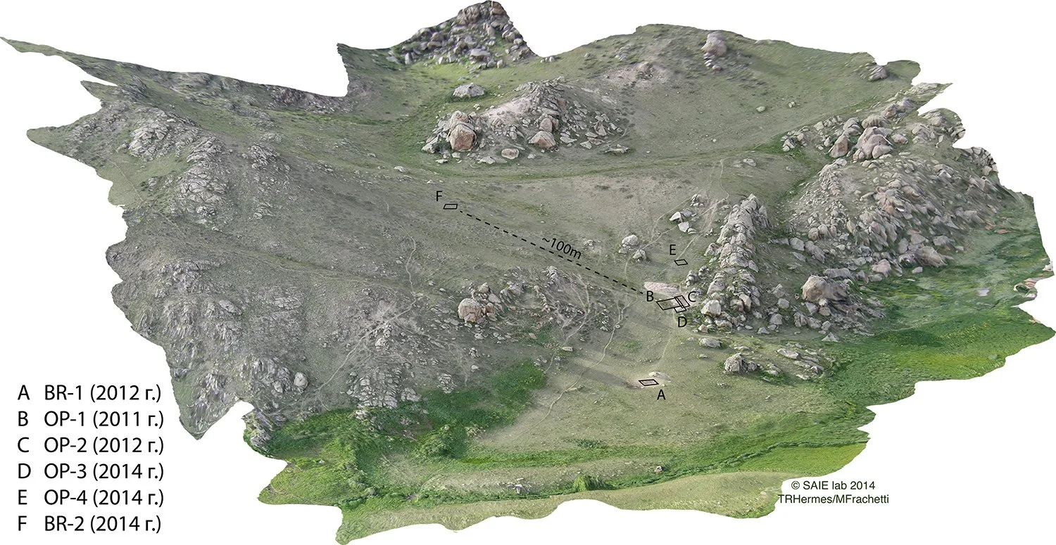
Located in the “seven rivers” region of southeastern Kazakhstan (Zhetisu or Semirech’ye), the Bayan-Zhurek valley provides a diverse ecological setting with abundant annual precipitation, ranging from roughly 500 mm to 1200 mm (dependent on elevation and aspect). Bronze Age settlements and burials at Dali were discovered in 2010 under the aegis of the Dzhungar Mountains Archaeology Project (DMAP). Located at roughly 1550m elevation, the Dali site complex is situated within a sloping ravine on the eastern spur of the Bayan-Zhurek escarpment, which defines the northern slope of the Bayan-Zhurek Valley
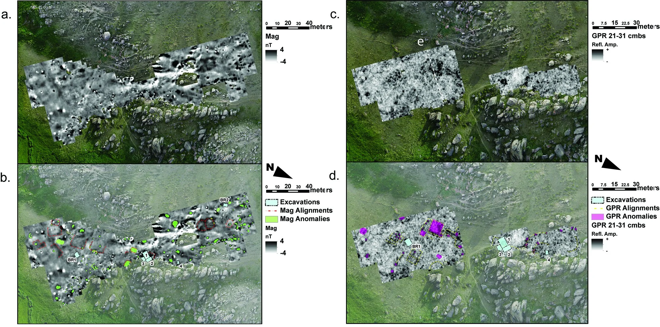
Near-surface geophysical surveys were carried out in 2013, including both magnetic gradiometry and ground-penetrating radar (GPR). GPR data were processed into amplitude slice maps roughly 13-cm thick using the Geophysical Archaeometry Laboratory’s GPR-Slice v. 7.0 MT software program.
The geophysical imagery from Dali helped identify numerous isolated subsurface anomalies, as well as clear semi-circular and rectilinear alignments across the site area. The array of anomalies revealed through our geophysical surveys likely reflects a chronological palimpsest comprised of multiple dwellings, corrals, and burials that were built across the area of the site throughout its long-term occupation. Although each sensor revealed different kinds of anomalies, combining the results yields a visible pattern of settlements distributed across the site area along a North-South alignment (Fig. 5). When compared with associated features exposed in excavation, our visual and metrical analyses of the geophysical data suggests at least 10 house structures were distributed across the Dali site slope. The GPR results, in particular, show an alignment of 3-4 rectangular anomalies whose shapes conform with documented Bronze Age settlement foundation layouts in the region, such as those at Begash (Frachetti and Mar’yashev 2007).
Featured publications:
Hermes, T.R., Doumani Dupuy, P.N., Henry, E., Meyer, M., Mar’yashev, A.N.,Frachetti, M.D. 2021. The multi-period settlement “Dali” in southeastern Kazakhstan: Bronze Age institutional dynamics along the Inner Asian Mountain Corridor. Asian Perspectives. 60 (2): 345-381.
2019 Hermes, T.; Frachetti, M.D. ; Doumani Dupuy, P.; Mar'yashev, A. Nebel, A. ; Makarewicz, C. Early integration of pastoralism and millet cultivation in Bronze Age Eurasia. Proceedings of the Royal Society, B. 286 (1910) https://doi.org/10.1098/rspb.2019.1273